Kiev transport map
You can find on this page the Kiev transport map to print and to download in PDF. The Kiev transportation map presents the transports network and transport zones of the transit of Kiev in Ukraine.
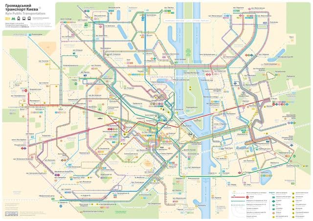
Kiev transports map
The Kiev transport map shows all means of transportation in Kiev. This transports map of Kiev will allow you to move easily with public transport of Kiev in Ukraine. The Kiev transportation map is downloadable in PDF, printable and free.
Public transportation in Kiev includes the metro (underground), buses, trolleybuses, trams and funicular. The metro is continuously expanding towards the city limits to meet growing demand, while the other kinds of public transport are not as well maintained. In particular, the public bus service has an unreliable schedule. Public electric trolleybus and tram lines as you can see in Kiev transport map are more reliable, but have aged equipment and are underfunded. The historic tram system, which once was a well maintained and widely used method of transport, is now gradually being phased out in favor of buses and trolleybuses. The taxi market in Kiev is expansive but not adequately regulated. In particular, the taxi fare per kilometer is not regulated. There is strong competition between private taxi companies.